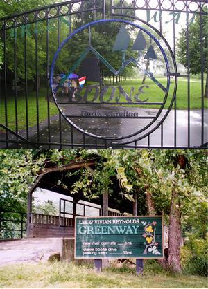
Town of Boone Greenway Trail
 ...Boone's hidden gem!
The Town of Boone's Greenway Trail runs from one end of Boone to the other, ducking under roads, meandering along multiple rivers, crossing several scenic bridges! This paved trail is less than 4 miles end to end, but allows cyclists a car-free in-town ride or short cut during a commute to work. There are many pea gravel and light trails that weave through the paved part of the greenway that give off-road cyclists a chance to play.
Access to the Greenway can be found in many locations throughout town, starting between Pride Drive & Southgate Drive (behind Coyote Kitchen), and no longer ends at Casey Lane near the Wastewater Treatment Plant! A recent expansion has connected the former "end" of the Greenway at Casey Lane to the Brookshire Park and Soccer Complex off Hwy 421. To discover this new section, cross the low water bridge and take a right turn. The pavement will turn to gravel as you parallel the river and Bamboo Road. There is a new underpass at Hwy 421 allowing you to ride under the highway and access the Brookshire/Soccer complex without having to cross the busy highway above! This is a wonderful addition, and a great option for a starting spot for your Greenway adventures featuring plenty of parking, water fountains, picnic shelters, and restroom facilities!
Two other popular areas to park and access the Greenway include the Watauga Community Recreation Center on Hunting Hills Lane and the parking area between the Watauga Medical Center parking deck & the Moose Lodge off Deerfield Road.
Follow this link to access a map of the Greenway! Feel free to print a copy, bring it by the shop, and get advice on the best roads to ride to get there!
CLICK HERE for trail condition updates.
